Locating Facilities Within the Master Facility List
Facilities in the MFL can be located via search and geolocation.
Location Through Search
The homepage has a search field that searches facilities by their code, name e.t.c.
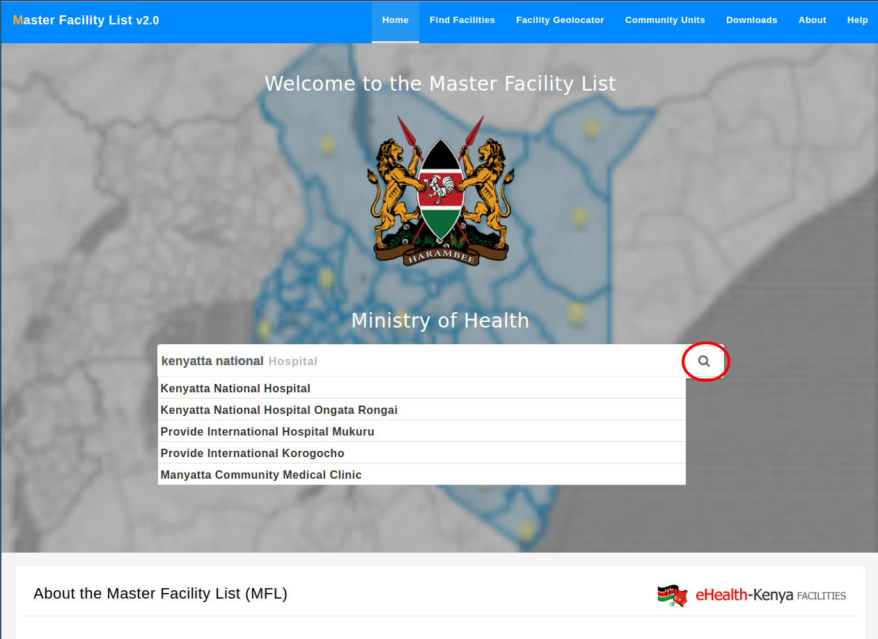
The results of the search are shown alongside the advanced search. Using the advanced search the query can be fine tuned e.g. viewing facilities in a certain ward.

The facility advanced search can also be accessed directly by selecting the find facilities button in the top navigation bar.
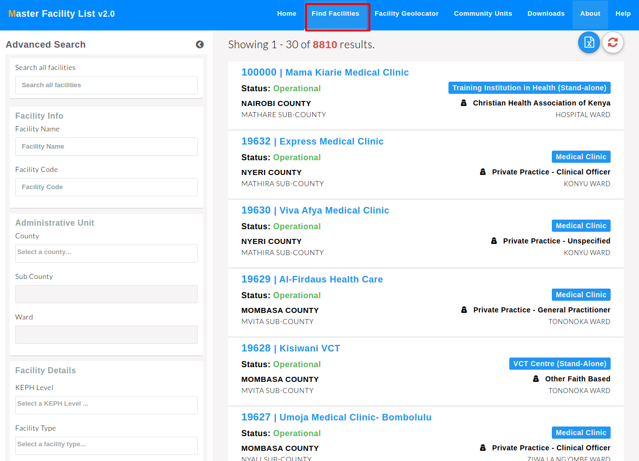
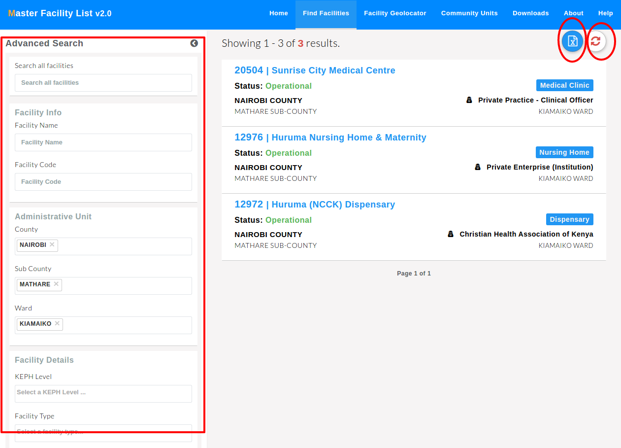
The advanced search form on the left has fields that can further specify your search.
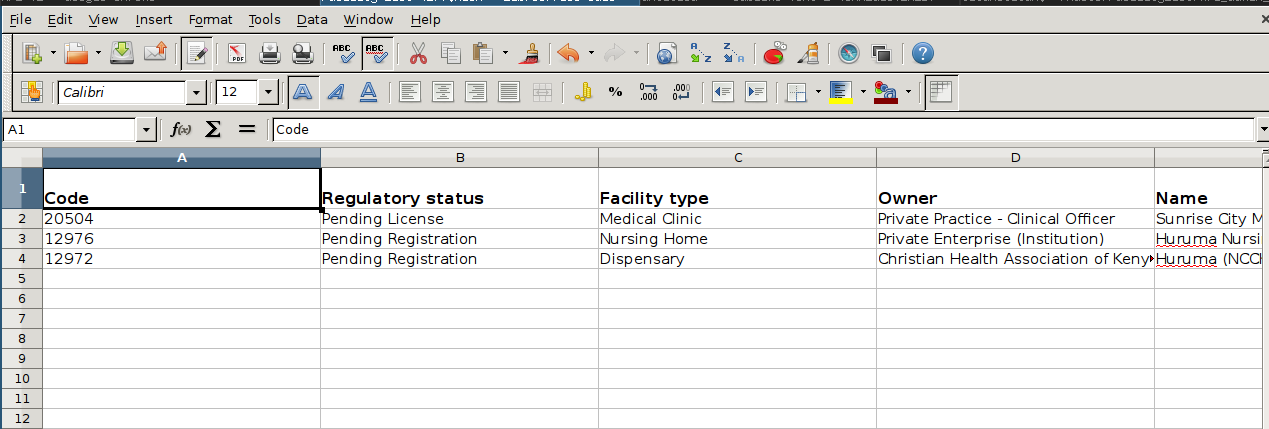
There’s an export facilities option that enables users to export and download the filtered facilities in excel format.
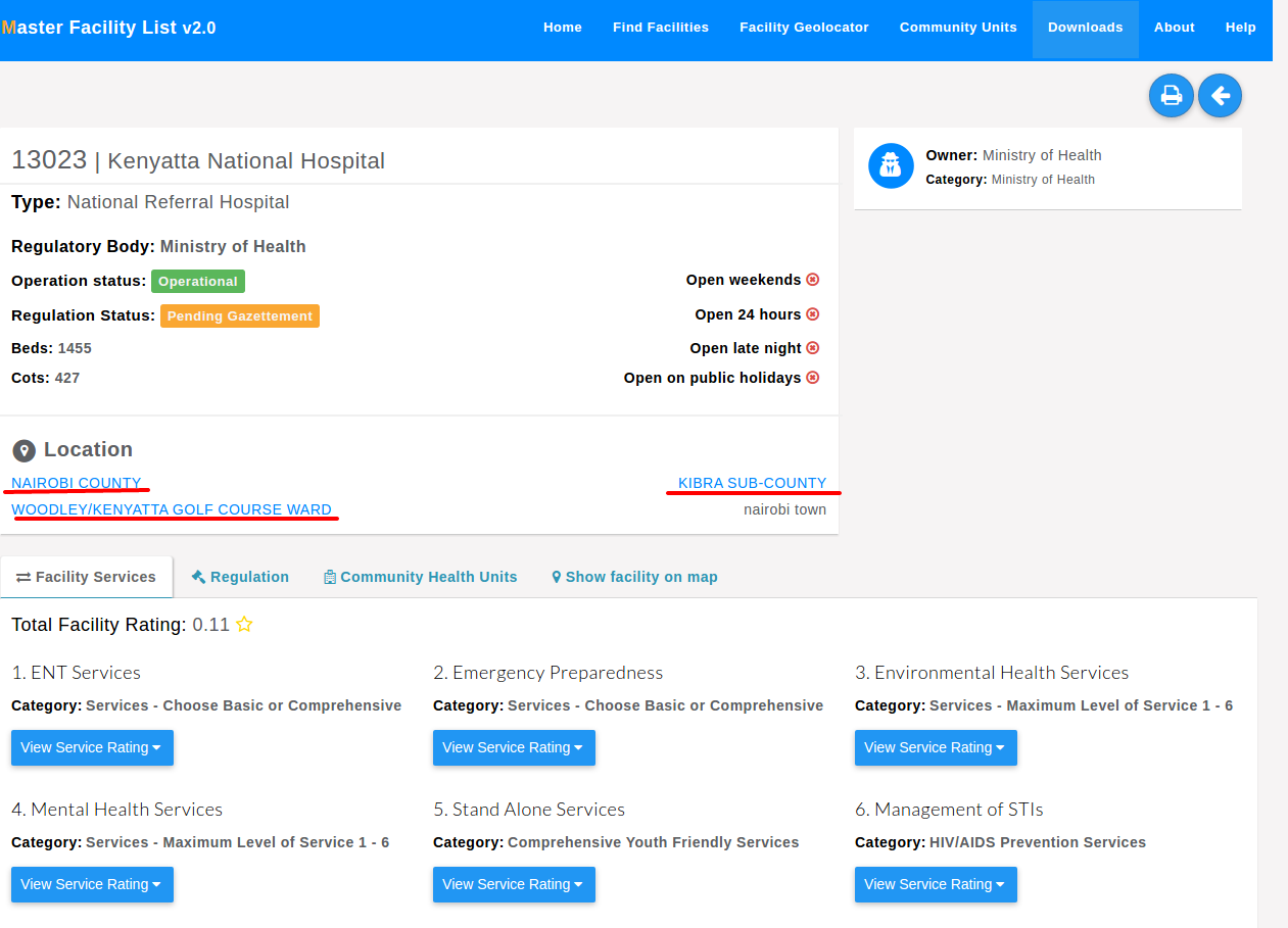
Opening one facility show more details about the facility. The basic details of the facility are displayed on top. Below the basic details, the facility’s services, location on a map, community units and (regulation) departments are displayed in tabs.
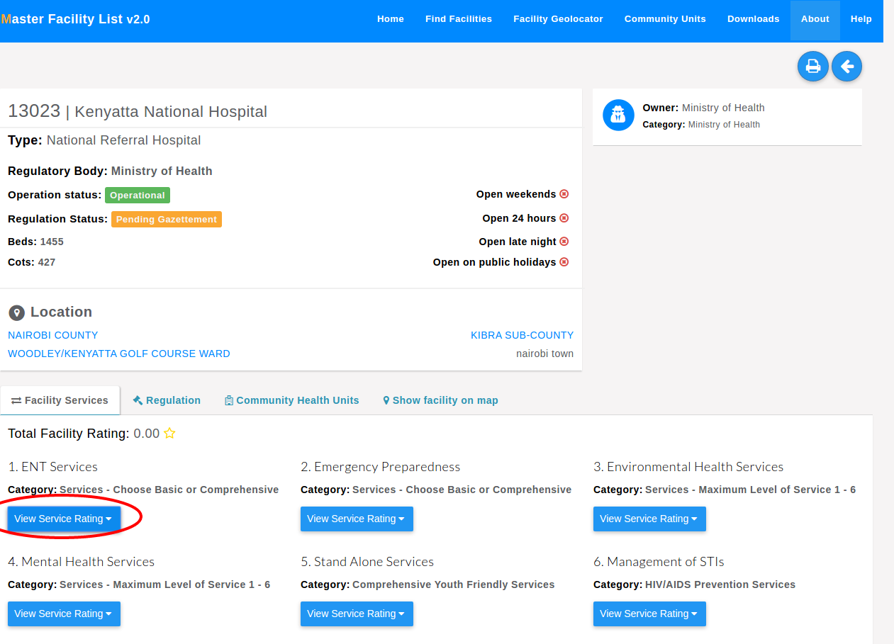
The facility services tab shows the services that the facility offers.

The facility’s administrative unit (county, sub-county and ward) links to geolocation of facilities within the selected facility administrative unit.
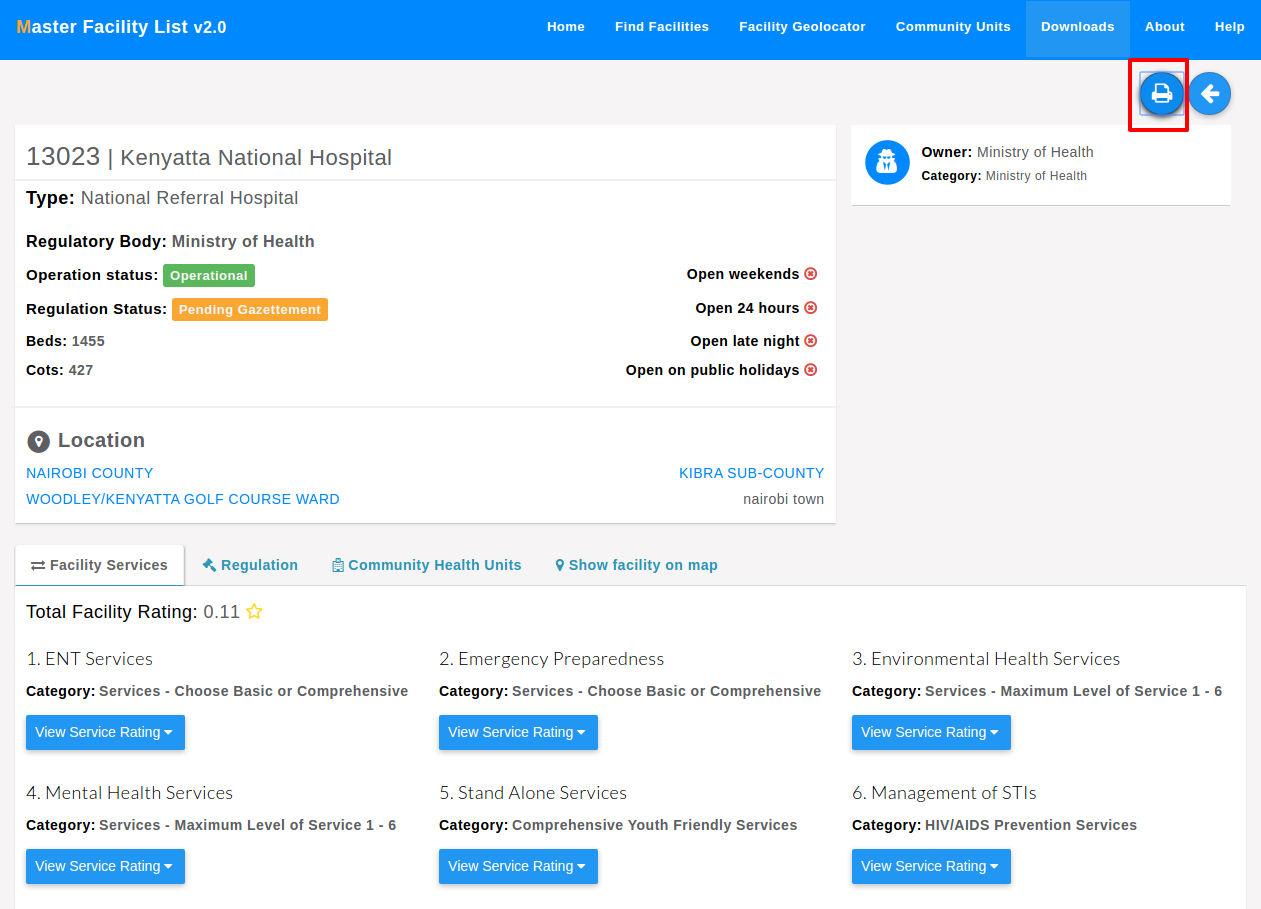
A printable version of the facility details is available by pressing the print button.
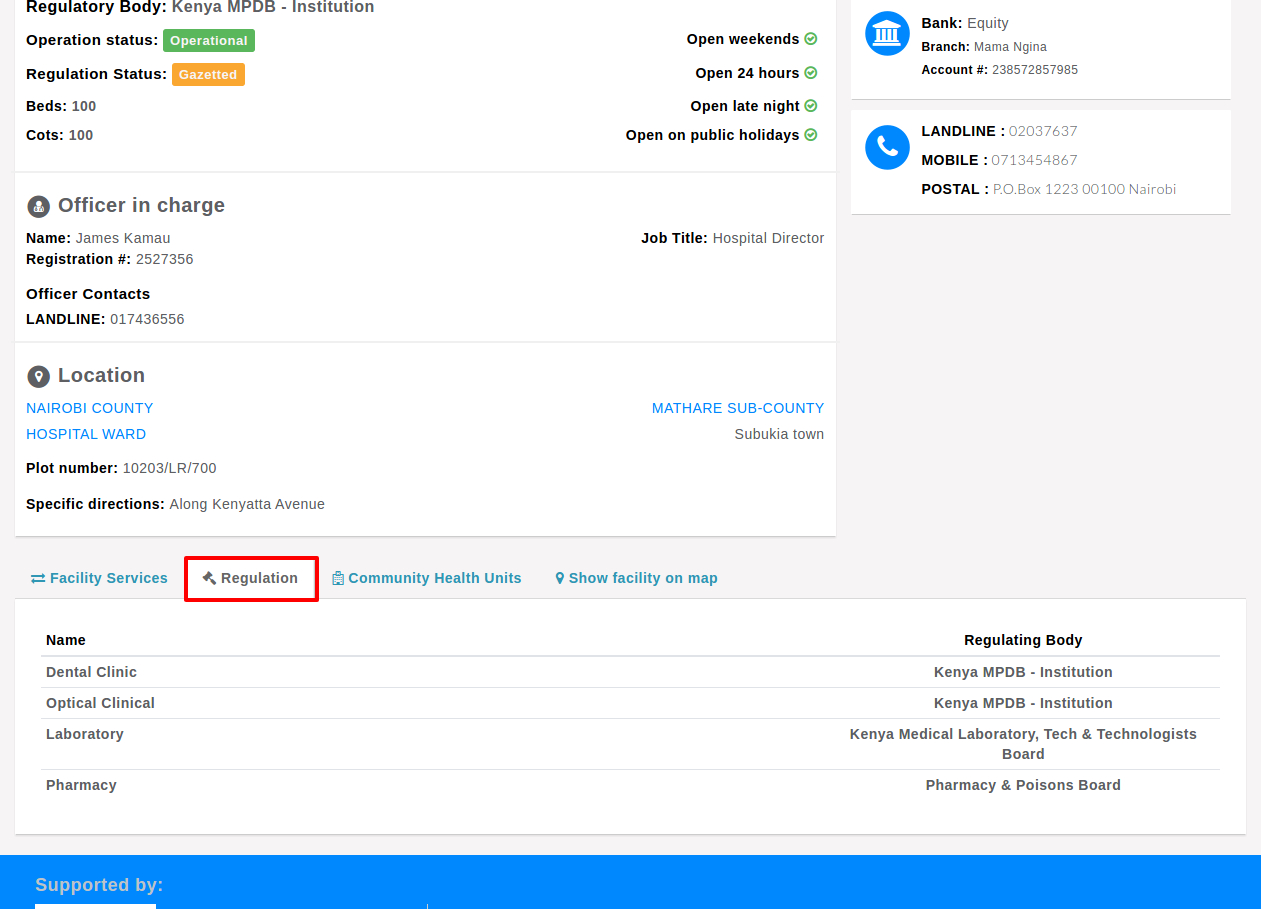
The regulation tab shows the departments that are in the facility.
The community health units tab displays the community health units that are attached to the facility. Clicking on one unit opens up more details about the unit.
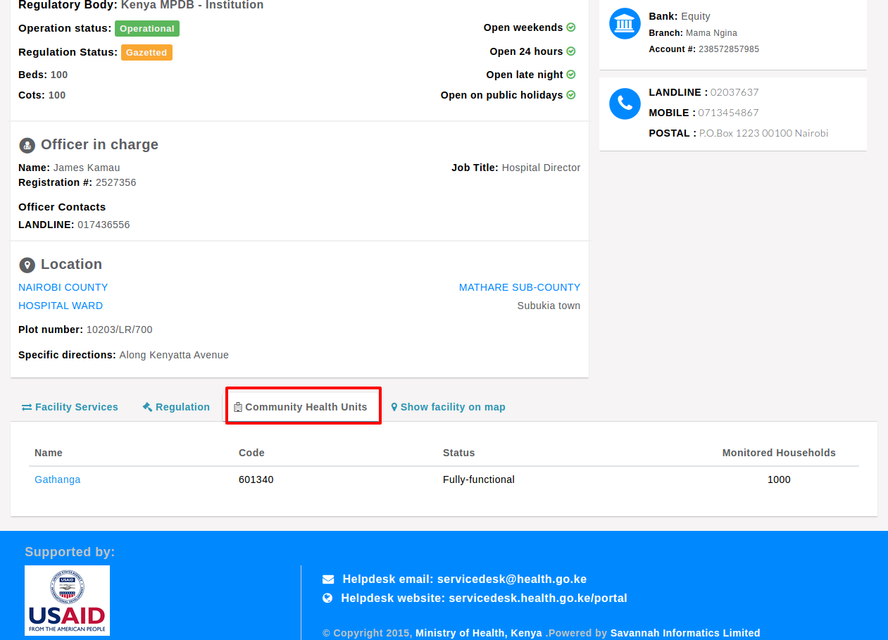
The show facility on map tab displays the position of the facility in the ward the facility is in.

Rating A Facility’s Services
Users are able to rate facility services by selecting the view service rating of the service to be rated. Rating is restricted to one service per day.
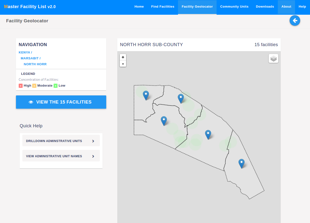
Location Through the Geo-locator
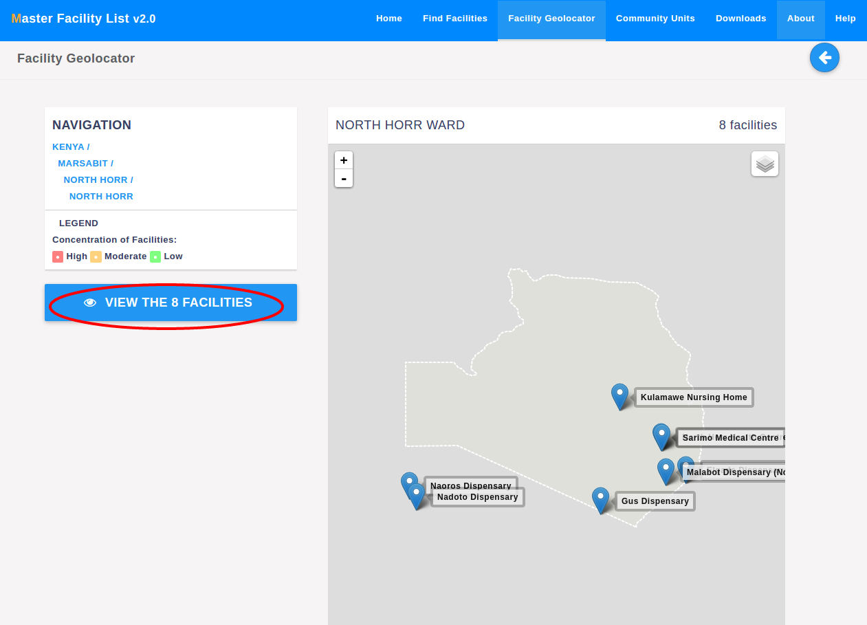
The geolocator is the second way of locating facilities. The geolocator is accessed using the facility geolocator button in the top navigation. The page shows the map of Kenya with all 47 counties. The map has a heatmap showing concentration of facilities in an area.
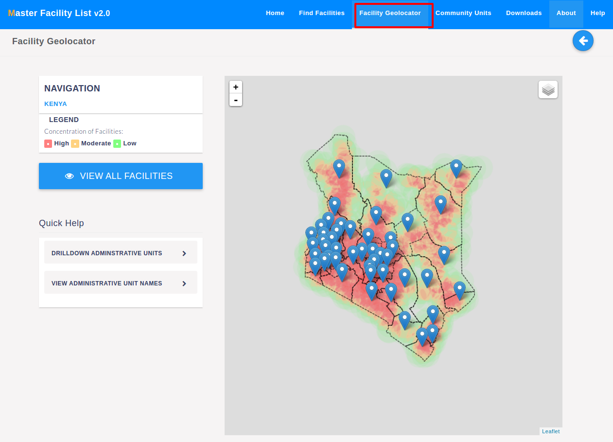
Clicking on one county brings up the selected county’s sub counties.
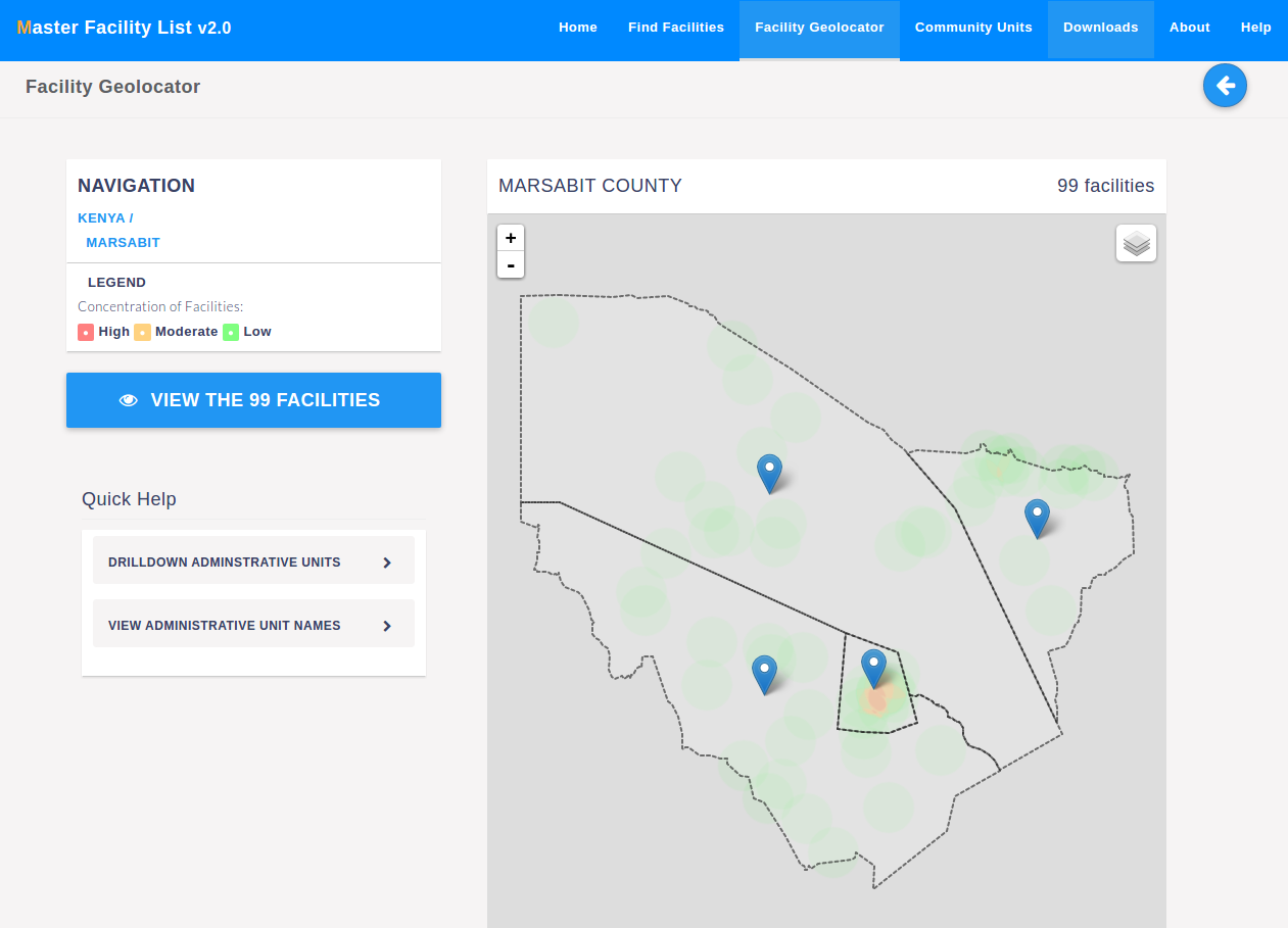
Clicking on one sub-county brings up the selected sub-county’s wards.
The ward level is the lowest administrative unit available.
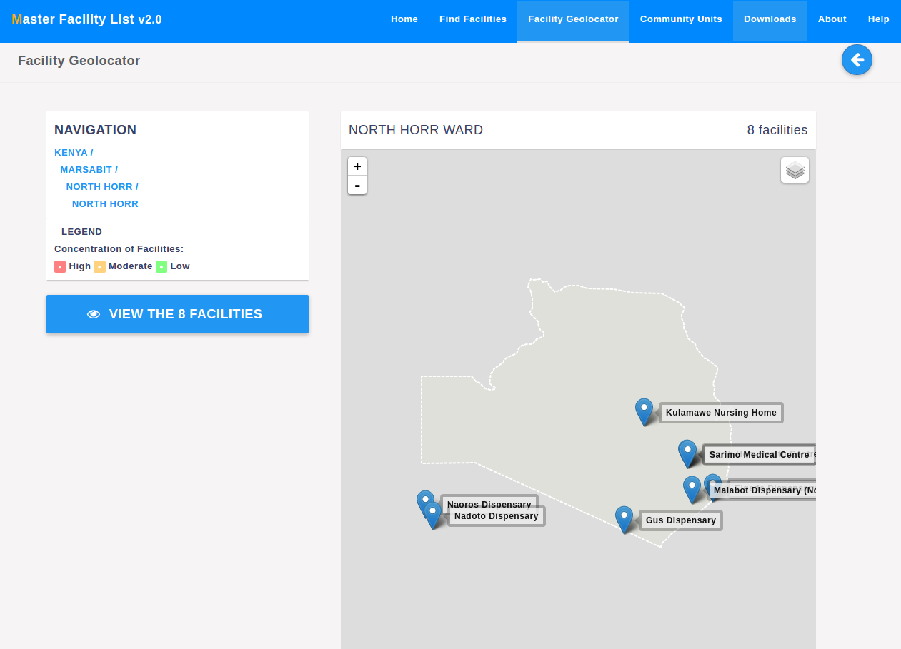
On the left of the map, there’s a button that can be used to view facilities in the administrative unit, in this case, the ward.